Specialized engineering
Comprehensive solutions in basic and detailed engineering for complex industrial projects.

Precision in every model
Intelligent 3D models with integrated technical information for reliable decision making.


AND MORE
PROJECTS
COMPLETED
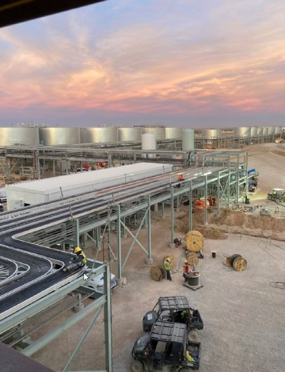
About Plant Design
3D Engineering
applied to the industry
Plant Design 3D is a Mexican company that emerges as a response to the
growing demand for specialized services in engineering, design, and
3D modeling for the industry.
We develop projects from the conceptual stage to final completion,
collaborating in the definition, design, and modeling of specific areas or complete
industrial plants.
We generate detailed plans for fabrication and assembly, as well as all the
necessary technical documentation to ensure efficient,
safe execution aligned with project standards.
Our services
Our services
01

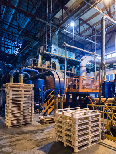
Structural Service
With extensive experience in structural detailing, we develop precise design plans using specialized technology and software, helping to optimize time and costs, with a focus on quality and technical reliability.
02

Intelligent 3D BIM Models
Plant Design 3D offers 3D BIM (Building Information Modeling) modeling services specialized for industrial plant projects, developing precise 3D models through BIM modeling and 3D laser scanning.
03

Piping BIM Services
We provide piping BIM modeling services for food and chemical plants, developing precise 3D models of process and utility systems.
04

3D Laser Scanning
We use advanced technology to capture real conditions and generate CAD and BIM models, supporting decision making and operational efficiency for our clients.
OUR SERVICES
Sectors Served


KNOW OUR WORK
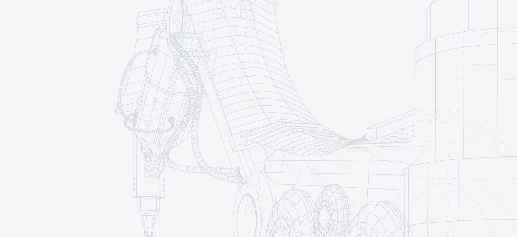
Focus on every
detail
Click and interact with our model
Discover all its details and specifications
Click and interact with our model
FAQ
-
Are laser scanners safe?
Yes. Most modern scanners use Class 1 infrared lasers, which are certified as completely safe for use in environments with people, posing no health risks.
-
How much does laser scanning for industrial plants cost?
The cost of laser scanning largely depends on the scope and size of the project. In industrial projects, the price is generally calculated per square foot or per square meter scanned.
For small projects, the rate is usually higher. As the project scope increases, the unit rate decreases considerably. -
Can scanning be performed while the plant is in operation?
Yes, it is possible, although not ideal. When the plant is in operation, there may be areas that cannot be captured due to safety restrictions, operational interference, or physical obstructions, which may limit the survey scope.
-
What will be captured during the scan?
Modern laser scanners offer extremely high fidelity, so the captured information presents a level of detail comparable to a photograph.
Like a camera, the scanner records everything within its field of view.
Measures can be taken to protect sensitive or confidential information; however, these areas must be identified and agreed upon prior to starting the scanning process. -
What are the tolerances and precision of the scan?
This is a complex topic. Generally speaking, the precision of an individual scan can reach approximately ±1 mm. However, this precision tends to decrease progressively as registration, post-processing, and modeling stages are incorporated.
A point cloud composed of multiple scans usually presents lower precision than a single scan, and a derived 3D model may present additional deviation.
As we advance to the modeling stage, important technical considerations also arise. For example, it is necessary to define if elements should be modeled orthogonal and aligned to facilitate design and construction, or if they should be represented exactly as found in the field, reflecting existing real deviations. -
How long does the scan take?
Tripod-mounted laser scanners have different capture times, which can vary from less than two minutes to approximately ten minutes for jobs requiring very high resolution.
Generally speaking, each scan usually takes around five minutes, allowing the team to move agilely within the survey area.
The total project time depends directly on the scope and assigned resources. -
How are elements not in the "line of sight" captured?
This is achieved by configuring multiple scan positions, which allow covering different angles and minimizing blind spots.
It is important to consider that all laser scanners for large areas operate on the principle of direct line of sight. -
How is a 3D / BIM model obtained from the scan?
While there are software tools like FARO As-Built that support and speed up the process, 3D/BIM modeling continues to be largely a manual process that requires time, technical judgment, and experience.
For this reason, Plant Design 3D has a specialized team of plant modelers, dedicated exclusively to transforming the point cloud into reliable and high-quality models. -
What delivery formats are generated upon processing completion?
For scanning jobs, we deliver information in widely used formats, including RCS / RCP, as well as native FARO formats.
Additionally, we develop CAD and BIM models on major market platforms, such as AutoCAD Plant 3D, Revit, and Navisworks Manage, among others, according to project requirements. -
How much time is required to convert scan data into CAD drawings?
The timeframe depends directly on the project scope and the number of assigned modelers.
As a general reference, the conversion and modeling process usually requires three to four times more time than used to perform the field scan. -
At what distance can laser scans be performed?
Modern laser scanners have a range exceeding 100 meters. However, information captured at those distances usually presents lower density and quality.
In most indoor surveys, it is not necessary to exceed a 25-meter range. As standard practice, Plant Design 3D limits or filters data captured beyond this distance to improve point cloud quality and reliability.
When long-range or height data is required, special equipment and techniques can be employed; however, these cases demand specific prior planning to ensure adequate results.

